


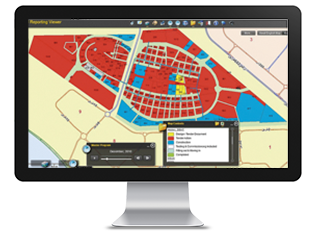
Presentation of a GIS system
The power of cartography
A Geographic Information System (GIS) allows us to visualize, query, analyze and interpret data to understand relationships, patterns and trends.
GIS benefits organizations of all sizes and in almost all industries. There is growing interest and awareness of the economic and strategic value in using GIS.
Effective cost reduction
GIS is widely used to optimize maintenance schedules and daily fleet movements. Typical implementations can save 10 to 30 percent of operational expenses by reducing fuel usage, staff time, better customer service and more efficient planning.
Better Decision Making
GIS is the leading technology for making better decisions about location. Common examples include real estate site selection, route / corridor selection, evacuation planning, conservation, natural resource extraction, etc. Making the correct location decisions is critical to an organization's success.
Improved Communication
GIS-based maps and visualizations greatly help in understanding situations and stories. It is a language that improves communication between different teams, departments, disciplines, professional fields, organizations and the public.
Secure registration
Many organizations have a primary responsibility for maintaining authorized records of state and geography change. GIS provides a solid framework for managing these types of records with comprehensive support and reporting tools.
Manage geographically
GIS becomes essential to understand what is happening and what will happen in the geographical space. Once we understand, we can prescribe an action. This new approach to geographic management is transforming the way organizations operate.